
Poised at the crossroads of innovation and rapid development, Saudi Arabia is redefining what modern infrastructure looks like on a global scale. Under the bold framework of Vision 2030, the Kingdom is not just expanding its economy but reimagining entire cities, ecosystems, and industrial landscapes.
With construction and commercial real estate investments projected to exceed SAR 1.3 trillion ($346 billion) by 2030, the pressure to deliver massive projects with speed, precision, and resilience is at an all-time high.
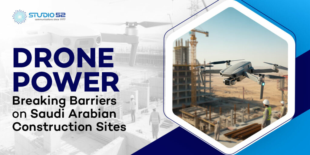
Mega-developments such as NEOM, Qiddiya, and the Red Sea Project span thousands of square kilometers, often across harsh and remote environments. Meeting these complex challenges requires more than traditional tools. Today, construction companies using drones are setting new benchmarks for efficiency, safety, and data-driven decision-making.
In parallel, commercial real estate drone photography is transforming how stakeholders visualize progress, assess assets, and plan future developments. As timelines tighten and expectations rise, drones are delivering the aerial intelligence needed to improve safety, control costs, and streamline operations across Saudi Arabia’s evolving construction landscape.
Table of Content
Drone-Powered Progress: Redefining Construction and Real Estate Across the Kingdom
Over the past few years, construction companies using drones have reported significant gains in productivity and reductions in project timelines and costs. Drones, also known as unmanned aerial vehicles (UAVs), are now central to site planning, progress monitoring, structural inspections, and post-construction marketing.
In commercial real estate drone photography, for instance, aerial imagery and video offer high-resolution, bird’s-eye perspectives of property developments and land parcels, which were previously either cost-prohibitive or logistically impossible. In Saudi Arabia’s vast desert landscapes and rapidly urbanizing zones, these high-definition visuals are instrumental in showcasing commercial viability to investors.
Pro Tip 1: Leverage drone data early in your project lifecycle for accurate site assessments and real-time progress tracking. This helps avoid costly delays and ensures decisions are backed by precise, up-to-date information.
Drones in Action: Tackling Construction Site Challenges Head-On
Saudi construction sites face unique challenges — from expansive desert terrain and extreme temperatures to difficult-to-access project zones and rapidly shifting topographies. Traditional surveying methods can be time-consuming and prone to error, especially when dealing with thousands of square kilometers of land.
Drones solve these issues through:
- Advanced Aerial Surveying
Equipped with LiDAR sensors and photogrammetry software, drones can map large areas with centimeter-level accuracy. This is particularly vital in early-stage land assessment in places like NEOM or The Line, where topographical accuracy underpins the design and execution of the master plans.
- Real-Time Progress Monitoring
Project managers can now deploy drones for weekly or even daily flyovers, producing up-to-date orthomosaic maps and 3D models of the entire construction site. This allows stakeholders to track work completed against the schedule, identify bottlenecks, and verify contractor performance.
- Safety and Risk Management
The General Authority of Civil Aviation (GACA) has put forth guidelines for drone operations, underscoring safety as a priority. Drones reduce the need for personnel to be physically present in hazardous zones such as high scaffolding, unstable terrains, or active machinery areas. This shift has been associated with a significant drop in onsite accidents and insurance claims in monitored projects.
- Inspection and Quality Assurance
In Saudi Arabia, where climatic conditions like heat and dust can accelerate material fatigue, drones offer a non-invasive, high-definition inspection capability. Cracks, corrosion, or structural misalignments can be captured early, documented, and rectified before escalating into larger issues.
Flying High on Data: Smarter Decisions Powered by Drones
One of the best things you get from using drones is useful information. High-resolution images, thermal scans, volumetric data, and 3D point clouds provide a treasure trove of actionable insights. In particular:
- Construction companies using drones in the Kingdom can analyze earthworks volumes, cut-and-fill data, and stockpile inventories with greater accuracy.
- In commercial real estate, developers can assess proximity to infrastructure, water bodies, and other key amenities, helping to inform feasibility and pricing strategies.
- Machine learning algorithms applied to drone datasets can identify patterns and automate anomaly detection, further refining decision-making processes.
According to recent regional reports, drone-aided construction sites have observed up to 25% faster project delivery times and 30% cost savings in logistical planning and rework mitigation.
Experience innovation as Drones Lead Saudi Construction toward smarter project management. Get accurate aerial insights, monitor progress, and improve efficiency with Studio52’s expert drone filming solutions
Clear Skies Ahead: How Saudi Arabia’s Regulations Empower Drone Innovation
Saudi Arabia is proactively regulating drone use through GACA’s online drone registration portal, making it easier for drone companies in Saudi Arabia to operate legally and safely. While certain zones remain restricted, such as near airports and military installations, commercial drone operators are increasingly being granted permits to serve the growing demands of the construction and real estate sectors.
Furthermore, as the Kingdom transitions toward smart cities, the integration of drone data into Building Information Modeling (BIM) and Geographic Information Systems (GIS) is being actively encouraged by urban planning authorities. This shows a strong, long-lasting focus on building projects based on data.
Wings of Change: The Growing Footprint of Drone Services Across the Sector
Industries like oil and gas, farming, mining, and tourism are quickly starting to use drones to help with their work. However, it is within construction and drone filming services for commercial real estate that the growth curve has been steepest.
With the Real Estate Development Fund (REDF) injecting billions of riyals into housing and mixed-use development, the need for precision mapping, inspection, and promotional content has surged. As a result, both government entities and private developers are actively seeking drone service providers with robust portfolios and deep regional expertise.
Pro Tip 2: Pick drone service companies that know the local rules well, like Studio52, to make sure your project runs smoothly and safely in Saudi Arabia.
Capturing Success: Drone Filming Revolutionizing Marketing and Investor Relations
High-quality aerial videos created by drone filming services are redefining how commercial real estate projects are marketed. In Saudi Arabia’s competitive investment landscape, developers use cinematic drone footage to capture not just buildings but the surrounding infrastructure, accessibility, and natural features.
These visuals are crucial in attracting foreign direct investment (FDI), a central tenet of Vision 2030. Moreover, with increased reliance on digital marketing, social media, and virtual tours, drone content enhances transparency and trust among investors, stakeholders, and end-users.
Studio52: Leading the Charge in Saudi Arabia’s Real Estate and Construction Innovation
As a trusted provider of drone services in Saudi Arabia, Studio52 stands at the forefront of this technological revolution. With decades of experience in the region and a strong understanding of local regulatory frameworks, Studio52 delivers end-to-end drone solutions for construction sites, real estate developments, and industrial inspections.
Whether you need commercial real estate drone photography, time-lapse videos for progress tracking, or cinematic drone visuals for investor presentations, Studio52 combines state-of-the-art equipment with unmatched regional expertise. Our tailored approach ensures every project receives the attention to detail and operational excellence it deserves.
Let Studio52 help you unlock the full potential of your project with professional drone solutions designed to overcome the unique challenges of Saudi Arabia’s demanding development environment.
From sky to site, we’ve got you covered. Contact us now to take flight with smarter project solutions!